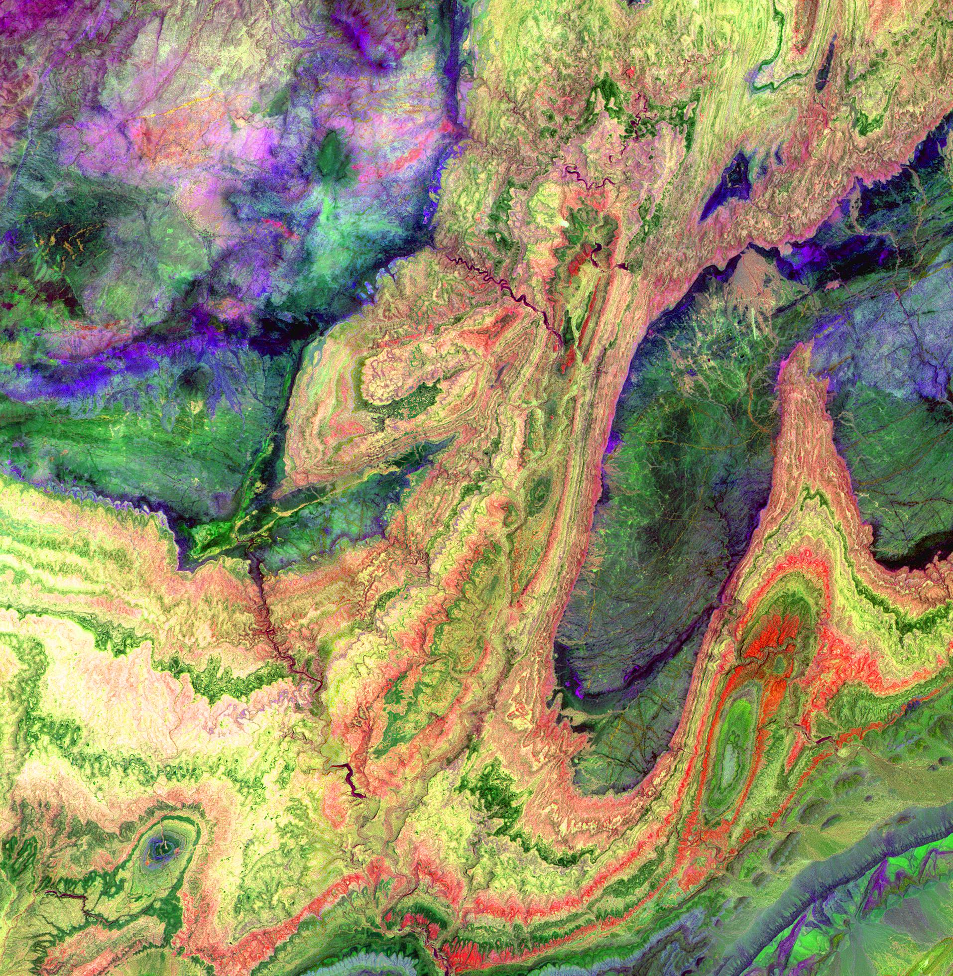
The Anti-Atlas Mountains of Morocco formed from the collision of the African and Eurasian tectonic plates about 80 million years ago. This collision destroyed the Tethys Ocean; the limestone, sandstone, claystone, and gypsum layers that formed the ocean bed were folded and crumpled to create the Atlas and Anti-Atlas Mountains. In this ASTER image, short wavelength infrared bands are combined to dramatically highlight the different rock types, and illustrate the complex folding. The yellowish, orange and green areas are limestones, sandstones and gypsum; the dark blue and green areas are underlying granitic rocks. The ability to map geology using ASTER data is enhanced by the multiple SWIR bands, that are sensitive to differences in rock mineralogy. The image, acquired on June 13, 2001, covers an area of 28.7 x 29.4 km located at 29.4 degrees north latitude and 8.9 degrees west longitude.
IMAGE AND TEXT CREDIT: NASA/METI/AIST/Japan Space Systems, and U.S./Japan ASTER Science Team
See More